Examined area, grid points load within sections matched with map (dwg,jpg...)
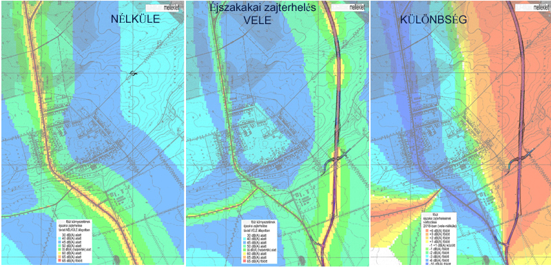
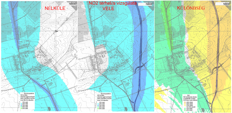
A presentation mode for larger areas, municipalities, regions' study results even with impact assessment documentation compatibility, which is able to represent calculations on node points with colormapped surface of noise and air loads map.
Studied areas and sections with calculated loads on matched base map (dwg, jpg...).
The example shows the map without identification marks, because of coprights..